Ultimate Travel Guide to Ladakh 2026: Our Family’s Breathtaking Journey
Part 3: Exploring Leh, Nubra and Pangong
Updated May 14, 2026
Welcome to Part 3 of our complete Travel Guide to Ladakh series your comprehensive, practical, and travel-tested roadmap to Leh town, Nubra Valley, and Pangong Lake. Ladakh blends stark high-altitude landscapes, ancient monasteries, crystal-clear lakes, and a rich Himalayan Buddhist culture.
This guide retains every original detail from our family notes while reorganising everything into a clearer, more logical flow with a clear, structured presentation all for ease of understanding and better planning.
We base everything on our real June 2024 family trip (with kids and middle-aged members) and cross-check it with the latest 2026 updates from BRO, Leh administration, and road status reports. For full planning details (permits, packing checklist, acclimatisation science, food dos and don’ts, and AMS management) refer to Part 1: Complete Planning Guide. For the epic road journey itself, see Part 2: Srinagar-Leh Highway.
Series Navigation
- Part 1: Complete Planning Guide (updated in 2026)
- Part 2: Srinagar – Leh Highway
- Part 3: Exploring Leh, Nubra, and Pangong (you are here)
- Part 4: Comprehensive Guide on Acute Mountain Sickness (AMS)
- Part 5: Understanding Ladakh and Its Buddhist Heritage

How to Reach Leh
Leh serves as the primary gateway to Ladakh. You can reach it by air or road. Each option offers different trade-offs in speed, acclimatisation, scenery, and logistics. Choose what best fits your trip, health, and schedule.
By Air
The fastest way to reach Leh is by flight. A direct flight from Delhi to Leh takes roughly 5 hours. Flights operate frequently during the peak season (May-September), though fares rise significantly then.
Leh’s Kushok Bakula Rimpochee Airport (IXL) mainly connects through Delhi, with seasonal direct flights from other major Indian cities during summer.
2026 Update| Important family tip: Allow at least 48 hours of complete rest after landing for acclimatisation. Leh sits at about 11,500 ft (3,500 m), so even fit travellers need time to adjust. Avoid any excursions on arrival day. Our family found two full rest days in Leh made a huge difference, especially for the kids.
By Road
Driving to Leh becomes an adventure and a visual feast. Two main road corridors connect Leh with the plains: the Srinagar Leh Highway and the Manali Leh Highway. Each has specific opening times, altitude gains, and permit requirements.
Option 1: Delhi → Kullu/Manali (by air) → Leh (by road via Manali)
Many travellers fly to Kullu or Manali to save time on the long plains drive, then complete the mountain leg by road.
- Distance (Kullu → Leh): ~490 km when the Manali-Leh Highway is open.
- The route crosses several high passes: Rohtang La (≈3,978 m), Baralacha La (≈4,890 m), Lungalacha La (≈5,059 m), and Tanglang La (≈5,328 m).
- The Atal Tunnel now bypasses the Rohtang gap and provides better all-weather access to the upper valley. However, the full Manali-Leh Highway generally opens in late May to early June, depending on snow clearance.
- Travel time: A continuous drive can take ~14 hours, but due to rapid altitude gain and safety, plan overnight halts for acclimatisation (common stops: Sarchu or Jispa; avoid very high spots like Sarchu if possible for families).
- Permits: Obtain them in advance from Himachal tourism portals or local offices (Green Tax Office in Manali, SDM in Keylong, or Leh authorities).
Option 2: Delhi → Srinagar (by air) → Leh (by road via Srinagar-Kargil-Leh Highway)
Many prefer this route for more gradual altitude gain. Our family chose it and found it safer and more scenic.
- Distance: ~417 km from Srinagar to Leh.
- Major passes include Zoji La, Namika La, and Fotu La (highest on this stretch).
- Best window: The highway typically opens in late March or April; May is the safest. June July see more traffic.
- Travel time: A non-stop drive takes 9-10 hours, but we strongly recommend breaking the journey with an overnight halt in Kargil (8,780 ft) to acclimatise and explore en route.
- Pro tip: Many travellers ascend via Srinagar (gradual) and return via Manali (higher resting points but steeper climbs). This combination helps with overall acclimatisation.
2026 Update: Road Update: As of April 2026, the Srinagar-Leh highway remains green and motorable (with possible slippery sections). Zojila Tunnel excavation is nearing completion, with full all-weather connectivity targeted for 2028. Always check live BRO and Leh district status before travel.

Best Time to Visit Ladakh
Summer (May-September)
This is the best overall window. All roads open, camps and home-stays operate fully, and weather stays mild enough for sightseeing, photography, and light trekking. June-August offer the most stable conditions with warm days and cool nights.
Shoulder Months (April and late September)
Conditions turn variable, some routes may open late or close early, with fewer crowds but higher weather risks.
Winter (October-February)
Temperatures drop sharply with heavy snow. This period suits only specialists and the famous Chadar Trek (when the Zanskar River freezes). Most roads close to civilian traffic. Our family visited in June 2024 and found ideal weather for exploration, though we still needed careful acclimatisation.

Key Attractions
Leh Town & Nearby Monasteries
Leh Palace: Built by King Sengge Namgyal in the 17th century, this nine-storey structure resembles Lhasa’s Potala Palace. Visit early morning for fewer crowds and better light for photos.
Shey Palace & Monastery: Historic summer palace of the Ladakhi kings with a picturesque setting.
Thiksey Monastery: Located ~19 km from Leh, it houses a stunning 15-meter Maitreya Buddha statue. Attending early morning prayers offers an immersive cultural experience.
Hemis Monastery: The largest monastery in Ladakh, rich in festivals and artefacts. It sits about 45 km from Leh and provides a quieter, more peaceful atmosphere.
Druk Padma Karpo School: The iconic rural school featured in the film 3 Idiots; visible on many Leh sightseeing circuits.
Shanti Stupa: Built by Japanese monks in 1991 as a symbol of peace. It offers panoramic sunrise and sunset views over the Stok Range. You can climb roughly 500 steps from the base or drive up to save energy at altitude.
Leh Market: A compact market near Leh’s core selling handicrafts, jewellery, pashmina, and local food such as momos, thukpa, and butter tea. The Jama Masjid sits at a T-junction in the market. Non-Muslim visitors should dress respectfully.
Short Day Trips (Sangam, Magnetic Hill, Pathar Sahib)
These attractions lie along NH1 toward Srinagar and can easily be covered in an afternoon:
Sangam: Confluence of the Zanskar and Indus rivers (~35 km from Leh).
Magnetic Hill: Famous optical illusion where vehicles appear to roll uphill (~30 km from Leh).
Gurudwara Pathar Sahib: Sikh shrine near Leh where Guru Nanak is believed to have visited.
The Hall of Fame is often included in the same loop for its military history exhibits.
Journey to Nubra Valley via Khardung La: Practical Tips
Expect rapid altitude gain: From Leh (≈11,480 ft) to Khardung La (~17,582 ft), you gain ~6,000 ft in a short span. Prior full acclimatisation in Leh is essential.
South Pullu acts as the main checkpoint; allow time for permit and ID checks.
Road conditions vary: well-paved near Leh, but steeper and rougher near the pass. The Border Roads Organisation (BRO) maintains it frequently, yet landslides and army convoys can cause delays. Army convoys may lead to hour-long waits near Khardung La. Avoid lingering too long at the highest point to minimise altitude risks.
2026 Update: The Leh-Nubra route via Khardung La remains fully open and motorable as of April 2026.
Nubra Valley Overview
Nubra sits at an average altitude around 10,000 ft between the Ladakh and Karakoram ranges. The valley splits into two arms: Hunder and Diskit (along the Shyok River, western side) + Sumur and Panamik (along the Nubra River, eastern side). Nubra offers a beautiful contrast: rivers, green patches, white sand dunes, and the iconic double-humped Bactrian camels. Diskit serves as the administrative hub; Hunder remains the popular tourist settlement with dunes and camps.
Activities in Nubra
- ATV/quad biking, zip-lining, and sand dunes photography.
- Diskit Monastery: Home to a 106-foot Maitreya Buddha statue with multiple vantage points. We recommend visiting early (or before leaving Nubra) for a peaceful experience.
Camel Rides: Our Strong Caution
We advise against camel rides for several reasons:
- Safety risks from uneven handling and unpredictable camel behaviour.
- Hygiene issues: camels can be poorly kept, and odours may cling to clothing.
- Animal welfare concerns: many camels appear overworked, not right.
Instead, photograph the camels from a safe distance and enjoy the dunes on foot or with ATV options.
Turtuk: The Last Indian Village
Location & History: Turtuk lies in the Baltistan region near the Line of Control (LoC). It joined India in 1971 and opened to tourists in 2010.
Distance & Route: Approximately 85 km from Hunder (≈3-4 hours one-way, depending on road conditions).
Why Visit: Unique Balti culture, apricot orchards, carved wooden houses, and a landscape different from Leh and Nubra.
Restrictions: Foreign nationals cannot cross beyond specific military checkpoints. Thang is the last civilian-accessible point near the LoC and requires special permissions.
Tips: Start early, carry snacks, and consider an overnight homestay for an authentic local experience.

Journey from Nubra Valley to Pangong Tso (Shyok Route): Updated Overview
In recent years, the Khalsar-Agham-Shyok-Durbuk route has improved significantly thanks to BRO efforts and is now a popular option when travelling from Nubra to Pangong Tso.
Route Overview (Hunder to Pangong via Shyok)
Distance: ~170 km total.
Estimated travel time: Around 5-6 hours with photo stops (actual time depends on road and weather conditions).
Road Breakdown & Conditions (2026)
- Hunder → Diskit Monastery (~12 km): Good motorable road.
- Diskit → Khalsar (~21 km): Well-maintained; the road splits at Khalsar.
- Khalsar → Agham (~25 km): Comfortable driving stretch.
- Agham → Shyok (~47 km): Most sections now tarred; a short 10-12 km gravelly patch may still exist.
- Shyok → Durbuk (~16 km): Good motorable road.
- Durbuk → Tangtse → Pangong (~50 km): Excellent final stretch.
Important Notes
Altitude gain: From Nubra (3,000 m) to Pangong camps (4,300 m), you gain ~1,300 m quickly monitor AMS symptoms closely (see Part 4).
Refuelling: Small fuel pumps in Diskit, Khalsar, Durbuk, and Tangtse. Diskit station can be unreliable. Top up whenever possible. Emergency roadside vendors exist but charge higher rates.
Historical & Strategic Significance
Khalsar: Old caravan junction and today a key strategic point connecting Nubra, Pangong, and Siachen routes.
Agham: Linked to ancient Tibet trade paths via Wari La.
Shyok Valley: Historically part of the Silk Route; known locally as the River of Death due to its treacherous nature. The area remains strategically vital with visible Indian Army presence.
Durbuk & Tangtse: Former trading halts now important military and transit points.
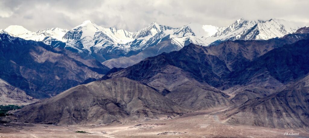
Pangong Tso: Facts and Visitor Notes
Length: The lake stretches around 134 km, with roughly 40% in India and 60% in China/Tibet.
Water Type: Saline; no fish, but it attracts migratory birds like bar-headed geese.
Freezing: Pangong freezes solid in winter when temperatures drop to -30°C to -35°C.
Scenic Value: Water changes colour dramatically throughout the day, best for photography at sunrise and sunset.
Access & Restrictions: The Indian Army controls certain stretches. Some sections remain off-limits. Always respect placards and instructions.
Sunrise & Camp Experience
Wake very early (around 05:00) to catch the famous Pangong sunrise. Nights stay freezing even in summer.
Camps (May-September): Seasonal and basic. Expect solar hot water (low pressure), bucket hot water on request, generator electricity for limited hours, communal dining, and fixed meal times. Permanent buildings are prohibited to protect the fragile ecosystem.

Accommodation, Food & Amenities
Leh: Wide range from budget guesthouses to luxury hotels. Many offer oxygen cylinders and medical assistance on request.
Nubra Valley (Diskit, Hunder, Sumur): Homestay, tented camps, and basic hotels. Sumur offers a quieter stay away from crowds.
Pangong Lake Camps: Water is tanked in (sometimes untreated). Stick to camp-provided meals and fixed schedules.
Food Tips (from our family experience)
Avoid heavy/oily/fried food as it slows digestion at altitude. Skip raw salads, uncooked street food, excessive dairy, unboiled water, alcohol (especially early days), aerated drinks, and cold beverages. Stick to boiled/filtered/bottled water, thukpa, momos, and simple Ladakhi meals.
Adventure Activities
- White-water rafting: Zanskar River (Chilling → Sangam stretch, Grade II-IV).
- Trekking: Markha Valley (6-8 days, moderate); Stok Kangri (6-9 days, experienced mountaineers only).
- Mountain biking: High-altitude routes around the passes.
Practical Travel Tips & Safety
Permits: Inner Line Permit (ILP) for Nubra, Pangong, and Turtuk. Indian tourists can apply online at lahdclehpermit.in. Vehicle permits needed for high passes. (2026 note: Indian tourists pay ₹700 environment/green fee; foreigners require PAP/RAP.)
Acclimatisation: Two full rest days in Leh mandatory. Descend immediately if AMS symptoms appear (headache, nausea, breathlessness).
Hydration & Clothing: Drink plenty of water. Use layered warm clothes. Nights are extremely cold.
Fuel & Cash: Top up fuel at every opportunity. Carry sufficient cash; ATMs limited outside Leh.
Connectivity: Mobile and internet patchy download offline maps.
Respect Local Customs: Dress modestly, ask before photographing people, no littering.
What to Avoid Eating/Drinking in Ladakh
- Heavy, oily, and fried foods
- Raw salads and uncooked street food
- Excessive dairy
- Unboiled or untreated water
- Alcohol (especially early in the trip)
- Aerated soft drinks and cold beverages
Responsible Travel & Animal Welfare
Avoid activities that compromise animal welfare (e.g., poorly managed camel rides). Support local guides and home-stays. Minimise single-use plastics and follow Leave No Trace principles.

Recommended Itinerary (Leh, Nubra & Pangong)
Duration: 9 days / 8 nights
A balanced, family-friendly pace with built-in acclimatisation days.
This itinerary is exactly how we structured our June 2024 family trip and worked very well for us (including kids and middle-aged members). It allows enough rest at the start while covering all major highlights without rushing.
Day 1: Arrival in Leh (Acclimatise)
Arrive at Leh airport or by road.
Check into your hotel and rest completely. Do not undertake any treks, long walks, or sightseeing. Keep activity minimal, stay hydrated, and listen to your body.
Day 2: Full Rest Day (Acclimatisation)
Continue resting. You may take a short, gentle walk in the Leh market only if you feel completely fine.
Avoid climbs, strenuous activity, or alcohol. Focus on hydration and light meals.
Day 3: Leh Local Sightseeing (Monasteries Circuit)
Suggested route: Leh Palace → Shey Palace & Monastery → Druk Padma Karpo School (famous from the movie 3 Idiots) → Thiksey Monastery → Hemis Monastery (or reverse the order depending on timing and energy levels).
Expect around 3-4 hours of driving excluding stops. Plan a full day with a slow, relaxed pace.
Day 4: Leh Local Sightseeing (NH1 Attractions)
Cover the popular attractions along NH1: Sangam (confluence of Zanskar and Indus rivers), Magnetic Hill, Gurudwara Pathar Sahib, Hall of Fame, and Shanti Stupa. These spots can comfortably be done in one afternoon.
Day 5: Leh → Nubra Valley via Khardung La
Drive to Nubra Valley via Khardung La (the pass is approximately 40 km from Leh, with the highest sections reaching 17,582 ft / 5,359 m).
Stop at South Pullu for permit and ID checks. Expect narrow, winding sections and possible BRO maintenance or army convoy delays.
In Nubra, visit Diskit Monastery and the giant Maitreya Buddha statue. Head to Hunder sand dunes in the evening for beautiful sunset photography.
Note: Avoid lingering too long at Khardung La due to thin air and cold winds, keep stops short.
Day 6: Nubra Full Day Excursion to Turtuk
Drive to Turtuk (approximately 85 km one-way from Hunder).
Explore the unique Balti culture, apricot orchards, and traditional carved wooden heritage homes.
Turtuk lies close to the Line of Control and was opened to tourists only in 2010. Respect all local rules and military restrictions in the area.
Day 7: Nubra → Pangong Tso via Shyok Route
Early morning: Visit Diskit Monastery if you missed it the previous day.
Then drive the scenic Shyok route: Khalsar → Agham → Shyok → Durbuk → Tangtse → Pangong Tso (approximately 170 km from Hunder; expect 5-6 hours with photo stops).
Book your lakeside camp in advance, as weather in the high-altitude region can change quickly.
Day 8: Pangong Tso → Leh via Chang La
Wake up before 05:00 to witness the magical sunrise at Pangong Lake and watch the famous changing hues of the water.
Drive back to Leh via Chang La pass (around 17,585 ft / 5,360 m). Make short stops at Durbuk and Tangtse on the return journey if needed.
Day 9: Departure from Leh
Depending on your flight or departure time, you can do a quick visit to the Leh market in the morning or head straight to the airport.
Final Reflections from Ladakh
This comprehensive Ladakh travel guide preserves every detail from our original family account while improving structure and readability. Ladakh rewards careful planning: acclimatise properly, respect local rules, and travel with awareness.
Our family returned with lifelong memories, deeper appreciation for the Indian Army’s courage, and profound humility before these majestic landscapes. Follow the 9-day itinerary, heed the tips we learned firsthand, and you will experience the same magic.
Ready for more?
- Read Part 4 for our complete AMS guide and what actually worked for our kids and family.
- Check Part 5 for the Buddhist heritage that touched us deeply.
- For deeper planning tools and permit details, see Part 1
Indian tourists can complete Inner Line Permits online at lahdclehpermit.in.
Safe travels, may the mountains welcome you as warmly as they welcomed us.
(All distances, altitudes, road conditions, and recommendations are based on our June 2024 family trip and have been cross-verified with April 2026 BRO and Leh administration updates. Always confirm live road and weather status closer to your travel dates.)