

The Ultimate Travel Guide to Ladakh: PART 3 – Exploring Leh, Nubra and Pangong
Introduction
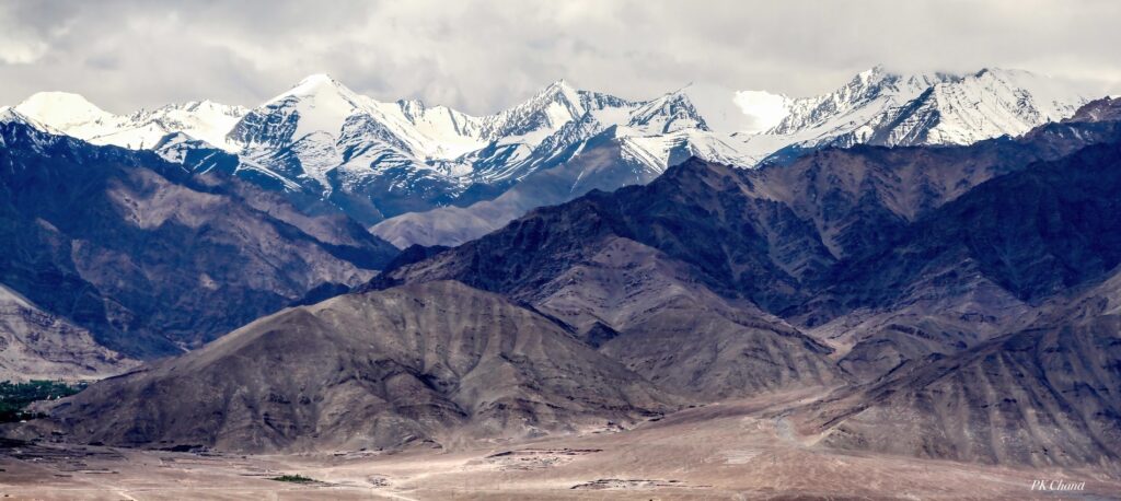
Welcome to the Ladakh travel guide 2025 — your comprehensive, practical, and travel-tested roadmap to Leh, Nubra Valley, and Pangong Lake. Ladakh blends stark high-altitude landscapes, ancient monasteries, crystal lakes, and a rich Himalayan culture. This guide keeps the original detail and adds SEO-friendly structure: clear subheadings, short paragraphs, active voice, transition words, and readable lists. For planning-level details (permits, packing checklist, acclimatization science) see the internal link to Majestic Ladakh – Complete Planning Guide.
The Ultimate Travel Guide to Ladakh
PART – 1: Complete Planning Guide
PART – 2: A Breathtaking Journey Via Srinagar to Leh Highway
PART – 3: Exploring Leh, Nubra and Pangong

How to Reach Leh
Leh is accessible by air and road. Each option has trade-offs: speed, acclimatization, scenery, and logistics. Read the following to decide what fits your trip.
By Air
- The fastest way to reach Leh is by flight. A direct flight from Delhi to Leh takes roughly5 hours.
- Flights run frequently during the peak window (May–September), but fares rise in that period.
- Leh’s Kushok Bakula Rimpochee Airport (IXL) connects mainly through Delhi; seasonal direct connections from other cities may run during summer.
- Important:Allow at least 48 hours for acclimatization after landing (complete rest; avoid excursions). The city sits at about 11,500 ft (3,500 m), so even fit travellers need time to adjust.
By Road
Driving to Leh is an adventure and a visual feast. Two main road corridors connect Leh with the plains: Manali–Leh and Srinagar–Leh. Each route has specifics on opening times, altitude gain, and permits.
Delhi → Kullu (by air) → Leh (by road via Manali)
- Many travellers fly to Kullu or Manali (to save time on long drives) and then complete the mountain leg by road.
- Distance (Kullu → Leh):~490 km when the Manali–Leh Highway is open.
- The Manali–Leh Highway crosses several high passes:Rohtang La (≈3,978 m), Baralacha La (≈4,890 m), Lungalacha La (≈5,059 m), and Tanglang La (≈5,328 m).
- TheAtal Tunnel now bypasses the Rohtang gap and provides all-weather access to the upper valley. However, the full Manali–Leh Highway generally opens in late May to early June depending on snow and road clearance.
- Travel time:Continuous drive can take ~14 hours; however, due to altitude gain and safety, plan overnight halts for acclimatization (Sarchu, Jispa are common stops).
- Permits:Obtain permits ahead from Himachal tourism portals or local offices (Green Tax Office in Manali, SDM in Keylong, or Leh authorities).
Delhi → Srinagar (by air) → Leh (by road via Srinagar)
- Many prefer flying to Srinagar and driving via the Srinagar–Kargil–Leh Highway for more gradual altitude gain.
- Distance:~417 km Srinagar → Leh.
- Major passes en route includeZoji La, Namika La, and Fotu La.
- Best months:Typically the highway opens in late March or April, but May is the safest window. June–July are also common but crowded.
- Travel time:A direct non-stop drive is ~9–10 hours, but we recommend breaking the journey (Kargil is an ideal stop) to acclimatize and explore en route.
- Tip:Many travellers go up via Srinagar and return via Manali. This helps with acclimatization because Manali–Leh road has higher resting points and steep climbs.
Best Time to Visit – Ladakh travel guide
- Summer (May–September):The best overall window. Roads open, camps and homestays operate, and weather is mild for sightseeing and trekking.
- Shoulder months (April, late September):Can be variable — some routes may open late or close early.
- Winter (October–February):Harsh temperatures and heavy snow. Ideal only for specialists and the Chadar Trek(when the Zanskar River freezes). Most roads close to civilian traffic.

Recommended 9-Day Itinerary (Leh, Nubra, Pangong)
Duration: 9 days / 8 nights (a balanced pace that includes acclimatization)
Day 1: Arrival in Leh (Acclimatize)
- Arrive at Leh airport. Check in and rest.
- Do not undertake treks or long walks. Keep activity minimal and hydrate.
Day 2: Full Rest Day (Acclimatization)
- Stay indoors or do a short walk in the Leh market only if you feel fine.
- Avoid climbs, strenuous activity, or alcohol.
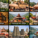
Day 3: Leh – Local Sightseeing (Shey, Thiksey, Hemis)
- Suggested route: Leh Palace → Shey Palace & Monastery → Druk Padma Karpo School (as seen in3 Idiots) → Thiksey Monastery → Hemis (or vice versa depending on timing).
- Expect ~3–4 hours driving excluding stops; plan a complete day with slow pace.
Day 4: Leh – Local Sightseeing (Shanti Stupa, Hall of Fame, Magnetic Hill)
- Cover Sangam, Magnetic Hill, Gurudwara Pathar Sahib, Hall of Fame, and Shanti Stupa.
- These attractions are along NH1; you can do them in an afternoon.
Day 5: Leh → Nubra Valley (via Khardung La)
- Drive to Nubra viaKhardung La (approx. 40 km from Leh to the pass; highest sections around 17,582 ft / 5,359 m).
- Stop atSouth Pullu for permits and checks. Expect narrow, winding sections and possible BRO maintenance activity.
- In Nubra, visit Diskit Monastery and Maitreya Buddha. Head to Hunder sand dunes for sunset photography.
- Note:Avoid lingering too long at Khardung La (thin air, cold); keep stops short.
Day 6: Nubra – Excursion to Turtuk
- Drive toTurtuk (≈85 km one-way from Hunder); see Balti culture, apricot orchards, and heritage homes.
- Turtuk lies close to the Line of Control and was opened to tourists in 2010. Respect local rules and restrictions.
Day 7: Nubra → Pangong Tso (via Khalsar – Agham – Shyok – Durbuk)
- Early morning: Visit Diskit Monastery if missed earlier.
- Drive the scenic Shyok route viaKhalsar → Agham → Shyok → Durbuk → Tangtse → Pangong (~170 km from Hunder; expect 5–6 hours with photo stops).
- Book lakeside camps in advance; weather can change quickly.
Day 8: Pangong → Leh (via Chang La)
- Sunrise at Pangong (wake before 05:00 to catch the changing hues).
- Drive back to Leh viaChang La pass (around 5,360 m / 17,585 ft).
- Stop at Durbuk and Tangtse on the return.
Day 9: Departure from Leh
- Depending on flight time, quick market visit or departure.

Key Attractions — Detailed Notes
Leh Town & Nearby Monasteries
- Leh Palace:Built by King Sengge Namgyal in the 17th century; nine-storey structure resembling Lhasa’s Potala. Best visited early morning for fewer crowds and better light for photos.
- Shey Palace & Monastery:Historic summer palace of the Ladakhi kings; picturesque setting.
- Thiksey Monastery:~19 km from Leh. It houses a 15-meter Maitreya Buddha statue. Early morning prayers provide an immersive cultural experience.
- Hemis Monastery:The largest monastery in Ladakh and rich in festivals and artifacts. It sits about 45 km from Leh and offers a quieter experience.
- Druk Padma Karpo School:The rural school featured in popular films; visible on some Leh circuits.
Shanti Stupa & Leh Market
- Shanti Stupa:Built by Japanese monks in 1991 as a symbol of peace. Offers panoramic sunrise and sunset views over the Stok Range. There are roughly 500 steps from the base, or you can drive up to save energy.
- Leh Market:A compact market near Leh’s core selling handicrafts, jewellery, pashmina, and local food (momos, thukpa, butter tea). Jama Masjid sits at a T-junction in the market — non-Muslim visitors should dress respectfully.
Short Day Trips (Sangam, Magnetic Hill, Pathar Sahib)
- Sangam:Confluence of Zanskar and Indus rivers (~35 km from Leh).
- Magnetic Hill:Optical illusion where vehicles appear to roll uphill (~30 km from Leh).
- Gurudwara Pathar Sahib:A Sikh shrine near Leh where Guru Nanak is said to have visited.
- These attractions sit along NH1 toward Srinagar and can be done in an afternoon.
Journey to Nubra Valley via Khardung La — Practical Tips
- Expectrapid altitude gain: Leh (≈11,480 ft) to Khardung La (~17,582 ft) gains ~6,000 ft in a short span. Prior acclimatization in Leh is essential.
- South Pulluacts as the checkpoint; allow time for permits and ID checks.
- Road conditions vary: well-paved near Leh, steeper and rougher near the pass. BRO (Border Roads Organisation) maintains the road frequently, but landslides and convoy stops (army convoys) can cause delays.
- Traffic & convoys:Army convoys may cause hour-long delays near Khardung. Avoid long exposure at the highest point to minimise altitude risks.
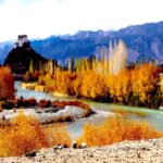
Nubra Valley Overview
- Nubra sits at an average altitude around10,000 ft between Ladakh and Karakoram ranges. The valley splits into two arms:
- Hunder & Diskit(along the Shyok River, western side), and
- Sumur & Panamik(along the Nubra River, eastern side).
- Nubra offers a contrast: rivers, green patches, white sand dunes, and the iconicBactrian camels.
- Diskit serves as the administrative hub; Hunder is the popular tourist settlement with dunes and camps.
Activities in Nubra
- ATV/Quad biking, ziplining, sand dunes photography.
- Diskit Monastery:Home to a 106-foot Maitreya Buddha statue and multiple vantage points.
- We recommendvisiting Diskit Monastery early (or before you leave Nubra) for a peaceful experience.
Camel Rides — Caution
- We advise against camel rides for several reasons:
- Safety risks:uneven handling and unpredictable camel behaviour can cause falls and injuries.
- Hygiene:camels can be poorly kept, and odours may cling to clothing.
- Animal welfare:many camels appear overworked and under-cared for.
- Instead, photograph camels from a safe distance and enjoy the dunes on foot or with ATV options.

Turtuk — The Last Indian Village
- Location & history:Turtuk lies in the Baltistan region near the Line of Control (LOC). It joined India in 1971 and opened to tourists in 2010.
- Distance & route:Approximately 85 km from Hunder (≈3–4 hours one-way depending on road conditions).
- Why visit:Unique Balti culture, apricot orchards, carved wooden houses, and a different landscape from Leh and Nubra.
- Restrictions:Foreign nationals cannot cross beyond specific military checkpoints; Thang is the last civilian-accessible point near the LOC and requires special permissions from local authorities.
- Tips:Start early, carry snacks, and consider an overnight homestay to experience local life.
Journey from Nubra Valley to Pangong Tso (Shyok Route) — Updated Overview
In recent years, the Khalsar – Agham – Shyok – Durbuk route has improved significantly due to BRO’s efforts. It is now a popular option when traveling from Nubra to Pangong Tso.
Route Overview (approximate): Hunder → Diskit → Khalsar → Agham → Shyok → Durbuk → Tangtse → Pangong Tso.
- Total distance from Hunder to Pangong (via Shyok):~170 km.
- Estimated travel time:Around 5–6 hours with photo stops. Road and weather conditions will change the timing.
Road Breakdown & Conditions
- Hunder → Diskit Monastery (~12 km):Good motorable road.
- Diskit → Khalsar (~21 km):Well-maintained; the road splits at Khalsar to lead to Nubra or toward the Shyok valley.
- Khalsar → Agham (~25 km):Comfortable driving stretch.
- Agham → Shyok (~47 km):The stretch historically required off-road skills, but BRO improvements have tarred most sections. Still, a 10–12 km patch near approx. 76–88 km from Hunder may remain rough and gravelly.
- Shyok → Durbuk (~16 km):Good motorable road.
- Durbuk → Tangtse → Pangong (~50 km):Road conditions are excellent in the final leg toward Pangong.
Important Notes
- Altitude gain:From Nubra (~3,000 m) to Pangong camps (~4,300 m) you gain ~1,300 m in a few hours — this is significant; be cautious and monitor for symptoms of AMS.
- Refuelling:Small fuel pumps exist in Diskit, Khalsar, Durbuk, and Tangtse. Diskit station can be unreliable; top up whenever possible.
- Emergency fuel:Some roadside vendors carry small quantities at higher rates — use only as a last resort.
Historical & Strategic Significance of Key Locations
This route and region carry layers of history — ancient trade, Buddhist culture, and modern strategic importance.
- Khalsar:Historically a caravan junction and today a key strategic road junction connecting Nubra, Pangong, and Siachen routes.
- Agham:A small but historically important junction linked to Wari La and trade paths to Tibet.
- Shyok Village and Valley:Historically connected to the Silk Route; the river’s treacherous nature earned it names like “river of death” in local lore. Recent military incidents and strategic road developments underline its contemporary importance.
- Durbuk & Tangtse:Stopping points and former trading halts that have evolved into strategic military and transit points.
- Pangong Tso:Long historical ties as a trans-boundary lake; it retains ecological and strategic significance.

Pangong Tso — Facts and Visitor Notes
- Length:The lake stretches around 134 km, with roughly 40% in India and 60% in China/Tibet.
- Water type:Saline; hence, it does not support fish, although it attracts migratory birds like bar-headed geese.
- Freezing:Pangong freezes in winter when temperatures fall to -30°C to -35°C.
- Scenic value:The water changes colour throughout the day, creating dramatic photographic opportunities.
- Access & restrictions:The Indian Army controls access near certain stretches. Some lake sections remain off-limits to tourists. Respect placards and army instructions.
Sunrise & Camp Experience
- Sunrise:To catch the famous Pangong sunrise, wake very early (around 05:00); nights are freezing even in summer at higher camps.
- Camps:Seasonal (May–September). Expect simple facilities: solar hot water, bucket hot water on request, limited electricity (generators), communal dining, and fixed meal times.
- Expectations:Permanent buildings are prohibited to protect the fragile ecosystem; camps can be rustic despite luxury marketing.

Accommodation, Food & Amenities
Leh
- Wide range: budget guesthouses to luxury hotels. Many hotels offer oxygen and medical assistance on request.
Nubra Valley (Diskit, Hunder, Sumur)
- Homestays, tented camps, and basic hotels. Facilities improve in Diskit and Hunder.
- Consider Sumur for a quieter stay away from crowds.
Pangong Lake Camps
- Seasonal camps; water is tanked in and occasionally untreated. Electricity is usually generator-based and limited to set hours.
- Hot water tends to be solar-heated and low-pressure; request hot water in buckets for showers.
- Meals:Camps follow strict meal schedules; arriving late can mean missing dinner.
Adventure Activities
- White-water rafting:Zanskar river offers multiple grades (II–IV). The Chilling → Sangam stretch is popular in summer.
- Trekking:Markha Valley (6–8 days) for moderate trekkers; Stok Kangri (6–9 days) for experienced mountaineers (challenging glacier sections).
- Mountain biking:Routes around the passes (Khardung La) offer high-altitude cycling; rent from Leh or bring your own.
Practical Travel Tips & Safety
- Permits:Carry Inner Line Permits for Pangong and Nubra. Get vehicle permits for high passes and check local requirements for Turtuk.
- Acclimatization:Rest two full days in Leh. If symptoms (headache, nausea, breathlessness) appear, descend immediately and seek medical help.
- Hydration & diet:Drink lots of water and avoid alcohol initially.
- Clothing:Pack layered warm clothes — nights are cold even in summer.
- Fuel & cash:Top up fuel when available. Carry cash as ATMs are limited outside Leh and not guaranteed.
- Connectivity:Mobile and internet can be intermittent; plan accordingly.
- Respect local customs:Dress modestly, ask before photographing people, and avoid littering.
What to Avoid Eating/Drinking in Ladakh
- Heavy, oily, and fried food – It slows digestion at high altitude.
- Raw salads and uncooked street food – Hygiene and water quality may be unreliable.
- Excessive dairy – Some travellers face digestion issues due to high-fat dairy.
- Unbolted or untreated water – Stick to boiled, filtered, or bottled water.
- Beverages to Avoid – Alcohol (especially early in the trip) – It causes dehydration and worsens altitude sickness; Aerated Soft Drinks – Gas causes bloating in high altitudes, and Cold Beverages – These can trigger throat infections in Ladakh’s dry weather.
Responsible Travel & Animal Welfare
- Avoid activities that compromise animal welfare (e.g., poorly managed camel rides).
- Use local guides and services to support village economies, but verify ethical practices.
- Minimise single-use plastics and follow Leave No Trace principles.
Conclusion & Call to Action
This comprehensive Ladakh travel guide 2025 preserves the full detail from the original account while improving structure, SEO, and readability. Ladakh rewards careful planning: acclimatize, respect local rules, and travel with awareness. If you’d like, I can now:
- produceimage placement suggestions with alt-text (key-phrase included),
- generatemeta tags and OG tags for Social sharing, or
- produce a2,000–3,500 word expanded version that keeps the original tone even more closely.
👉 For detailed information on altitude sickness and food safety, you may refer to a separate blog on Acute Mountain Sickness (AMS).
👉 For deeper planning tools and permit details (foreign travellers), check Complete Planning Guide. The Inner Line Permits (ILP) for Indian tourists can be completed online at lahdclehpermit.in


